Search Constraints
You searched for:
Period 17th century
Remove constraint Period: 17th centuryAssociated Places Great Britain
Remove constraint Associated Places: Great BritainSearch Results
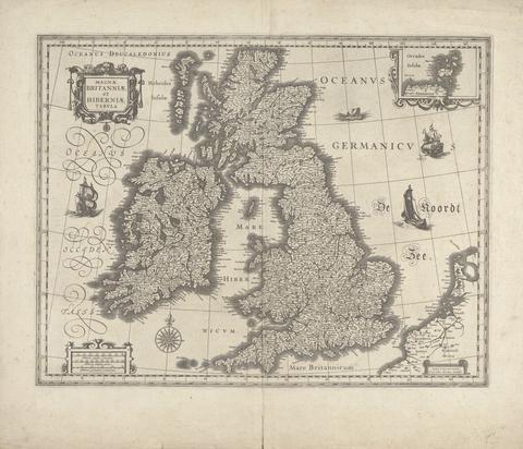
- Date:
- 1634
- Medium:
- Line engraving; verso: Letterpress on medium, slightly textured, cream laid paper
- Dimensions:
- Sheet: 19 7/8 × 23 1/4 inches (50.5 × 59.1 cm)
- Collection:
- Prints and Drawings
- Credit Line:
- Yale Center for British Art, Gift of Helen Chillman
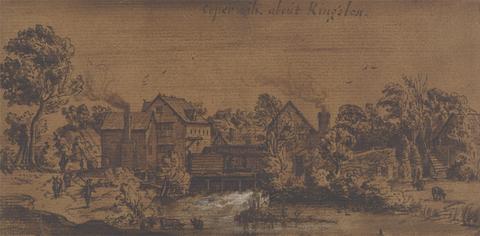
- Date:
- undated
- Medium:
- Brown wash and white gouache with pen and brown ink on medium, slightly textured, brown laid paper mounted on moderately thick, smooth, wove paper
- Dimensions:
- Sheet: 4 1/8 × 8 13/16 inches (10.5 × 22.4 cm)
- Collection:
- Prints and Drawings
- Credit Line:
- Yale Center for British Art, Paul Mellon Fund
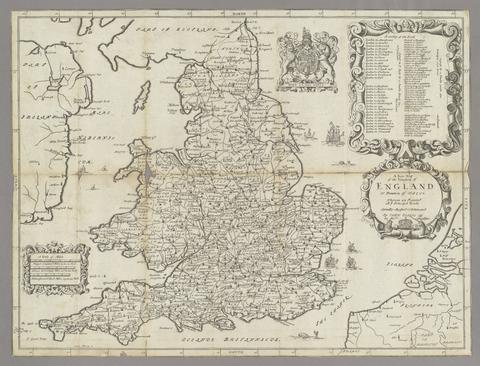
- Date:
- 1679
- Physical Description:
- [13], 27 p., [1] folded leaf of plates : map ; 20 cm.
- Collection:
- Rare Books and Manuscripts
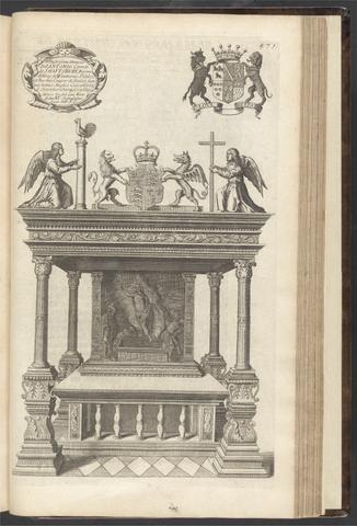
- Date:
- 1683
- Physical Description:
- 6 p. l., 578 (i.e. 588), [10] p., 1 l. : illus., plates (part double) 37 cm.
- Collection:
- Rare Books and Manuscripts
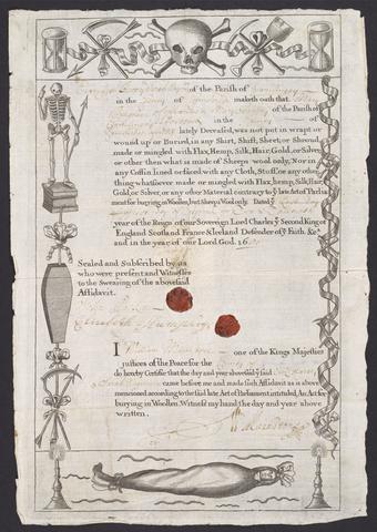
- Date:
- 1680 April 1
- Physical Description:
- 1 sheet (1 page) ; 31 x 22 cm
- Collection:
- Rare Books and Manuscripts
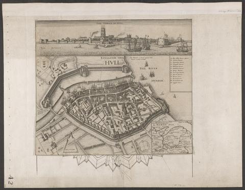
- Date:
- circa 1642
- Physical Description:
- 1 view : illustrations ; 31 x 30 cm
- Collection:
- Rare Books and Manuscripts
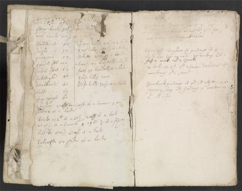
- Date:
- 1630s
- Collection:
- Rare Books and Manuscripts
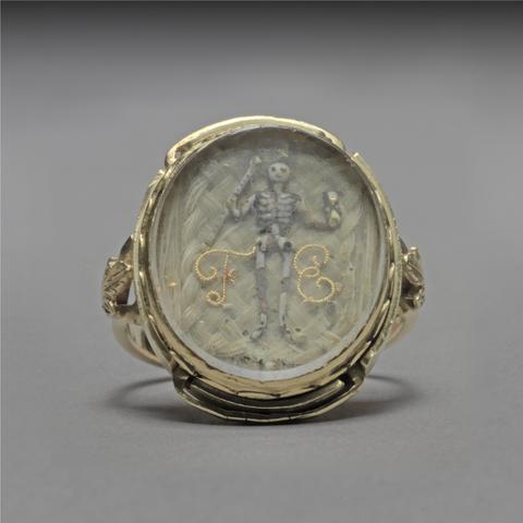
- Date:
- 1689
- Physical Description:
- 1 ring : gold, glass, ivory, gold wire, and hair ; face 21 x 17mm, band 20 mm in depth
- Collection:
- Rare Books and Manuscripts
- Credit Line:
- Yale Center for British Art, Gift of Susan M. Yecies, Yale BA 1971
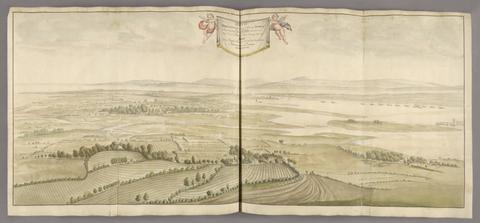
- Date:
- 1698
- Physical Description:
- 1 volume (157 leaves) : illustrations, maps, plans ; 53 cm
- Collection:
- Rare Books and Manuscripts
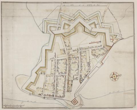
- Date:
- approximately 1678
- Physical Description:
- 1 map : pen-and-ink and watercolor ; 74 x 93 cm
- Collection:
- Rare Books and Manuscripts
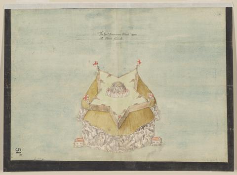
- Date:
- circa 1600
- Physical Description:
- 1 map : pen and ink and watercolor ; sheet 31 x 41 cm
- Collection:
- Rare Books and Manuscripts
![Practical perspective, or, Perspective made easie : teaching, by the opticks, how to delineate all bodies, buildings, or landskips, &c. : by the catoptricks, how to delineate confused appearences so as when seen in a mirror or pollisht body of any intended shape, the reflection shall shew a designe : by the dioptircks [sic], how to draw parts of many figures into one when seen through a glass or christal cut into many faces : usefull for all painters, engravers, architects, &c. and all others that are any waies inclined to speculatory ingenuity / by Joseph Moxon ; hydrographer to the Kings Most Excellent Majesty.](https://media.collections.yale.edu/thumbnail/ycba/bea2b2a2-7a36-4e4d-a2e3-8f691863231a)
- Date:
- 1670. (fol.)
- Physical Description:
- [6], 66 p., LX [i.e. 42] leaves of plates (2 folded) : ill. ; 32 cm. (fol.)
- Collection:
- Rare Books and Manuscripts
![Osbourne's Fort [graphic] / Trollup fecit.](https://media.collections.yale.edu/thumbnail/ycba/0410f4c8-238f-4611-ac47-552c11269168)
- Date:
- 1676
- Physical Description:
- 2 drawings : watercolor and pen and black ink ; sheets 29 x 37 cm
- Collection:
- Rare Books and Manuscripts
- Credit Line:
- Yale Center for British Art, Gift of Bruce Marshall Rare Books
![[The Popish Plot]](https://media.collections.yale.edu/thumbnail/ycba/2be72ef9-f36f-41b6-89ac-9cacab7676d6)
- Date:
- [1679?]
- Physical Description:
- 52 cards : ill. ; 90 x 54 mm.
- Collection:
- Rare Books and Manuscripts

- Date:
- 1673
- Physical Description:
- 1 sheet ; 23 x 21 cm
- Collection:
- Rare Books and Manuscripts
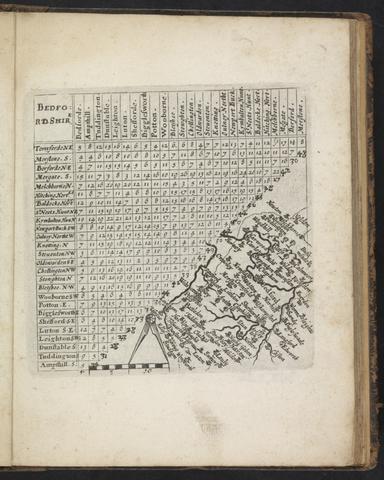
- Date:
- 1643
- Physical Description:
- [48] leaves (some folded) : maps ; 18 cm.
- Collection:
- Rare Books and Manuscripts
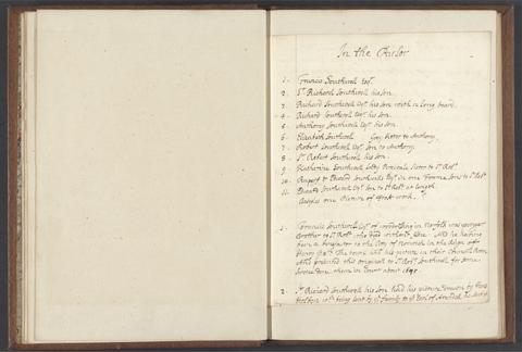
- Date:
- 1695
- Physical Description:
- 1 v. ([22] p.) ; 26 cm.
- Collection:
- Rare Books and Manuscripts
![The theatre of the empire of Great Britaine : presenting an exact geography of the kingdomes of England, Scotland, Ireland, and the iles adioyning : with the shires, hundreds, cities and shire-townes, within [the] kingdome of England / divided and described by Iohn Speed.](https://media.collections.yale.edu/thumbnail/ycba/05faa311-179e-44bd-a185-63bd2c871197)
- Date:
- [1612]
- Physical Description:
- [14], 146 [that is 280], [10] pages : illustrations (woodcuts), 67 maps (metal cuts) ; 46 cm (folio)
- Collection:
- Rare Books and Manuscripts
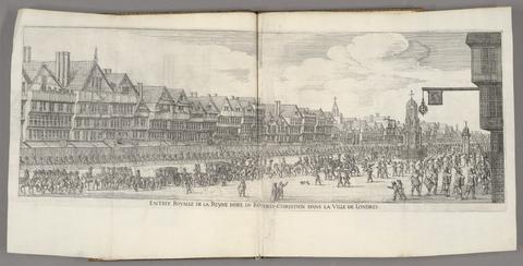
- Date:
- 1639
- Physical Description:
- 72 p., [9] leaves of plates (some folded) : port., ill. ; 41 cm.
- Collection:
- Rare Books and Manuscripts
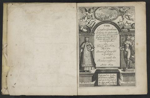
- Date:
- [1622]
- Physical Description:
- [14], 124, 129-162, 161-172, [1], 170-211, [1] p. : ill. (woodcuts) ; 19 cm. (4to)
- Collection:
- Rare Books and Manuscripts

- Date:
- [1678]
- Physical Description:
- 1 map : engraving ; 50 x 57 cm, on sheet 54 x 63 cm
- Collection:
- Rare Books and Manuscripts

- Date:
- 1693-ca. 1767
- Physical Description:
- 1 volume : ill. ; 17 cm.
- Collection:
- Rare Books and Manuscripts

- Date:
- 1644
- Physical Description:
- 1 atlas ([1], [6] leaves) : 6 folded maps ; 23 cm.
- Collection:
- Rare Books and Manuscripts

- Date:
- 1640
- Physical Description:
- 16, 331, 52, 76 p. : coats of arms ; 31 cm. (folio)
- Collection:
- Rare Books and Manuscripts

- Date:
- [1667]
- Physical Description:
- 8 p.l., 167 p. : ill. ; 17 cm.
- Collection:
- Rare Books and Manuscripts

- Date:
- 1676
- Physical Description:
- [4], 64 p. ; 20 cm.
- Collection:
- Rare Books and Manuscripts

- Date:
- [1671?]
- Physical Description:
- 1 map : pen and ink and watercolor ; sheet 64 x 75 cm
- Collection:
- Rare Books and Manuscripts

- Date:
- 1687
- Physical Description:
- [8], 207 p., [1] folded leaf of plates ; 20 cm.
- Collection:
- Rare Books and Manuscripts

- Date:
- 1897
- Physical Description:
- [8], iv, [32] pages : illustrations ; 27 cm
- Collection:
- Rare Books and Manuscripts

- Date:
- 1641
- Physical Description:
- 18 p. : ports. ; 20 cm.
- Collection:
- Rare Books and Manuscripts

- Date:
- 1663
- Physical Description:
- [110], 110 p. ; 15 cm.
- Collection:
- Rare Books and Manuscripts

- Date:
- 1676
- Physical Description:
- [16], 204, [4] p., [4] leaves of plates : ill. ; 21 cm.
- Collection:
- Rare Books and Manuscripts

- Date:
- [1645]
- Physical Description:
- 1 map : engraving ; 40 x 30 cm, on sheet 50 x 60 cm
- Collection:
- Rare Books and Manuscripts

- Date:
- [1650]
- Physical Description:
- 1 atlas ([16], 5-8, 146 [i.e. 280], [10] pages) : illustrations, maps ; 45 cm (folio)
- Collection:
- Rare Books and Manuscripts

- Date:
- ca. 1680
- Physical Description:
- 1 map : pen and ink and gray wash ; sheet 45 x 57 cm
- Collection:
- Rare Books and Manuscripts

- Date:
- 1600
- Physical Description:
- 1 map : pen and ink and watercolor ; 42 x 58 cm, on sheet 44 x 59 cm
- Collection:
- Rare Books and Manuscripts

- Date:
- [1681?]
- Physical Description:
- broadside. col. ill. 42 x 33 cm.
- Collection:
- Rare Books and Manuscripts

- Date:
- 1618
- Physical Description:
- [1], [99] leaves : all ports. ; 28 cm.
- Collection:
- Rare Books and Manuscripts

- Date:
- MDCLXXV [1675]
- Physical Description:
- 1 atlas ([34], 200, [4] pages, [203] leaves of plates (some folded)) : illustrations, maps ; 44 cm (folio)
- Collection:
- Rare Books and Manuscripts

- Date:
- [1661]
- Physical Description:
- [32], 645, [41] p., [32] leaves of plates (some folded) : ill., maps, plans ; 13 cm.
- Collection:
- Rare Books and Manuscripts

- Date:
- 1608
- Physical Description:
- [6], 190, [1] p., [2] leaves of plates : ill. ; 34 cm.
- Collection:
- Rare Books and Manuscripts

- Date:
- 1689
- Physical Description:
- [8], 108, [4] p., [1], 21 leaves of plates : ill. ; 18 cm.
- Collection:
- Rare Books and Manuscripts

- Date:
- December, 1671
- Physical Description:
- 1 map : pen and ink and watercolor ; sheet 76 x 120 cm
- Collection:
- Rare Books and Manuscripts

- Date:
- [1657]
- Physical Description:
- 1 atlas (234 pages in various pagings, [3] leaves of plates) : illustrations, maps, plans ; 52 cm (folio)
- Collection:
- Rare Books and Manuscripts

- Date:
- 1681-1683
- Physical Description:
- 2 v. : ill. ; 34 cm.
- Collection:
- Rare Books and Manuscripts

- Date:
- MDCLXXVI [1676]
- Physical Description:
- [16], 126, 5-6, 5-8, [22], 129-146, [14], 56, [12] pages, [2] leaves of plates : illustrations, coats of arms, tables ; 46 cm (folio)
- Collection:
- Rare Books and Manuscripts

- Date:
- anno cum privilegio 1616
- Physical Description:
- 1 atlas ([8], 94, [2], 99-126, [2], 131-132, [2], 137-146, [6] leaves) : maps ; 44 cm (folio)
- Collection:
- Rare Books and Manuscripts

- Date:
- ca. 1680
- Physical Description:
- 1 map : pen and ink ; sheet 102 x 72 cm
- Collection:
- Rare Books and Manuscripts

- Date:
- [between 1671 and 1707]
- Physical Description:
- [1] sheet : ill. ; 24 cm.
- Collection:
- Rare Books and Manuscripts

- Date:
- [Amsterdam?] :
- Physical Description:
- 1 atlas ([44] leaves of plates) ; 44 maps ; 13 x 18 cm.
- Collection:
- Rare Books and Manuscripts

- Date:
- MDCLXXII [1673]
- Physical Description:
- [14], 464 pages, [63] leaves of plates (50 folded) : coats of arms, maps ; 36 cm (fol. in 4s)
- Collection:
- Rare Books and Manuscripts

- Date:
- 1651
- Physical Description:
- [60], 540 p., [4] leaves of plates : ports. ; 15 cm (12mo)
- Collection:
- Rare Books and Manuscripts

- Date:
- [1671?]
- Physical Description:
- 2 maps on 1 sheet : pen and ink and watercolor ; sheet 64 x 76 cm
- Collection:
- Rare Books and Manuscripts

- Date:
- 1693
- Physical Description:
- 2 volumes : maps, illustrations ; 55 cm (fol.)
- Collection:
- Rare Books and Manuscripts

- Date:
- 1680
- Physical Description:
- [16], 175, [1] p. : ill. ; 16 cm.
- Collection:
- Rare Books and Manuscripts

- Date:
- 1672
- Physical Description:
- 23 p., [21] leaves of plates : ill. ; 21 cm.
- Collection:
- Rare Books and Manuscripts

- Date:
- 16--]
- Physical Description:
- 52 cards. ill. (ports.) 11 cm.
- Collection:
- Rare Books and Manuscripts

- Date:
- 1689
- Physical Description:
- [2], 37 p. ; 20 cm. (4to)
- Collection:
- Rare Books and Manuscripts

- Date:
- [1646?]
- Physical Description:
- 1 atlas ([57] leaves) : 57 maps ; 44 x 56 cm
- Collection:
- Rare Books and Manuscripts

- Date:
- 1627
- Physical Description:
- [16], 146, [10] pages, [134] leaves of plates : maps ; 45 cm (folio)
- Collection:
- Rare Books and Manuscripts

- Date:
- MDCLXXV [1675]
- Physical Description:
- 1 atlas ([26], 200, [4] pages, [203] leaves of plates (some folded)) : illustrations, maps ; 43 cm (folio)
- Collection:
- Rare Books and Manuscripts

- Date:
- [approximately 169-?]
- Physical Description:
- 1 sheet ([1] page.) ; 17 x 14 cm
- Collection:
- Rare Books and Manuscripts

- Date:
- [1671]
- Physical Description:
- [13] leaves : chiefly ill. ; 19 x 30 cm.
- Collection:
- Rare Books and Manuscripts

- Date:
- MDCLXXII [1673]
- Physical Description:
- [14], 464 p., [113] leaves of plates (some folded) : ill., 50 maps plan ; 36 cm. (fol.)
- Collection:
- Rare Books and Manuscripts

- Date:
- 1661-1662?
- Physical Description:
- 7 drawings : pen and ink and watercolor ; sheets 20 x 30 cm to 39 x 100 cm
- Collection:
- Rare Books and Manuscripts

- Date:
- [1671?]
- Physical Description:
- 1 map : pen and ink and watercolor ; sheet 69 x 80 cm
- Collection:
- Rare Books and Manuscripts

- Date:
- 1675-1676
- Physical Description:
- 2 v. ; 38 cm.
- Collection:
- Rare Books and Manuscripts

- Date:
- 1649
- Physical Description:
- [12], 66 p. ; 20 cm. (4to)
- Collection:
- Rare Books and Manuscripts

- Date:
- 1691
- Physical Description:
- [32], 348, [2] p., [1] leaf of plates : ill. ; 18 cm.
- Collection:
- Rare Books and Manuscripts

- Date:
- 1625
- Physical Description:
- [40] p. : ill. (woodcuts) ; 19 cm. (4to)
- Collection:
- Rare Books and Manuscripts

- Date:
- [1630?]
- Physical Description:
- [25] leaves : all ports. ; 28 cm.
- Collection:
- Rare Books and Manuscripts

- Date:
- [approximately 1695]
- Physical Description:
- 1 map : engraving, hand colored ; 46 x 56 cm, on sheet 51 x 61 cm
- Collection:
- Rare Books and Manuscripts

- Date:
- 1690
- Physical Description:
- 1 map : pen and ink and watercolor ; 43 x 111 cm
- Collection:
- Rare Books and Manuscripts

- Date:
- An. Dom. 1611
- Physical Description:
- [8], 200, [4], 201-204, 207-250, [4] pages : illustrations, music ; 18 cm (4to)
- Collection:
- Rare Books and Manuscripts

- Date:
- 1607
- Physical Description:
- [16], 860, [23] p., [3] leaves of plates : ill., port., maps ; 32 cm.
- Collection:
- Rare Books and Manuscripts

- Date:
- 1697
- Physical Description:
- [8], 159, [1] p. : ill. ; 12 cm. (12mo)
- Collection:
- Rare Books and Manuscripts

- Date:
- [1677?]
- Physical Description:
- 48 leaves (some folded) : maps ; 13 cm.
- Collection:
- Rare Books and Manuscripts

- Date:
- July 20, 1682
- Physical Description:
- 1 map : pen and ink and watercolor ; 32 x 25 cm, on sheet 38 x 36 cm
- Collection:
- Rare Books and Manuscripts

- Date:
- 1681-1682
- Physical Description:
- 2 maps : pen and ink and watercolor ; each sheet 39 x 42 cm
- Collection:
- Rare Books and Manuscripts

- Date:
- 1604
- Physical Description:
- [9] leaves, [8] leaves of plates : illustrations ; 38 cm
- Collection:
- Rare Books and Manuscripts

- Date:
- 1681-1682
- Physical Description:
- 13 sheets : pen and ink and watercolor ; sheets 68 x 72 cm, or smaller
- Collection:
- Rare Books and Manuscripts

- Date:
- [1698]
- Physical Description:
- 1 atlas (78 pages) : manuscript, 17 maps, pen and ink and watercolor ; 37 cm
- Collection:
- Rare Books and Manuscripts

- Physical Description:
- Imprinted at London : By George Eld, 1610.
- Collection:
- Rare Books and Manuscripts

- Date:
- 1670
- Physical Description:
- [12], 113, [5], 82, [4], 138, [6], 56, [2], 55, [1] pages, [25] folded leaves of plates : 25 maps ; 43 cm (folio)
- Collection:
- Rare Books and Manuscripts

- Date:
- circa 1680
- Physical Description:
- 1 map : pen and ink and gray wash ; sheet 85 x 170 cm
- Collection:
- Rare Books and Manuscripts

- Date:
- circa 1600
- Physical Description:
- 1 map : pen and ink and watercolor ; sheet 31 x 41 cm
- Collection:
- Rare Books and Manuscripts

- Date:
- 1651
- Physical Description:
- [16], 187, [3] p. ; 15 cm. (8vo)
- Collection:
- Rare Books and Manuscripts

- Date:
- 1688-1715
- Physical Description:
- 1 volume ; 45 cm
- Collection:
- Rare Books and Manuscripts

- Date:
- [1681?]
- Physical Description:
- 1 map : pen and ink and watercolor ; sheet 36 x 51 cm
- Collection:
- Rare Books and Manuscripts

- Date:
- [circa 1610?]
- Physical Description:
- 1 atlas ([110 ] leaves) : 55 maps ; 43 cm
- Collection:
- Rare Books and Manuscripts

- Date:
- 1694 April 27
- Physical Description:
- 1 item ([1] p.) ; 28 x 31 cm.
- Collection:
- Rare Books and Manuscripts

- Date:
- ca. 1680
- Physical Description:
- 1 map : pen and ink and watercolor ; 67 x 94 cm
- Collection:
- Rare Books and Manuscripts
93. Catalogue of the tombs in the churches of the city of London, A.D. 1666. By Major Payne Fisher, B.A.

- Date:
- Printed 1668, Privately reprinted 1885
- Physical Description:
- vii, 94, [1] p. 29 cm.
- Collection:
- Reference Library
- Date:
- [1970]
- Physical Description:
- 16 p., 230 plates : 2 col. illus., coats of arms, maps. ; 54 cm
- Collection:
- Reference Library