Search Constraints
You searched for:
Associated Places Great Britain
Remove constraint Associated Places: Great BritainSubject Terms Great Britain -- Maps -- Early works to 1800.
Remove constraint Subject Terms: Great Britain -- Maps -- Early works to 1800.Search Results

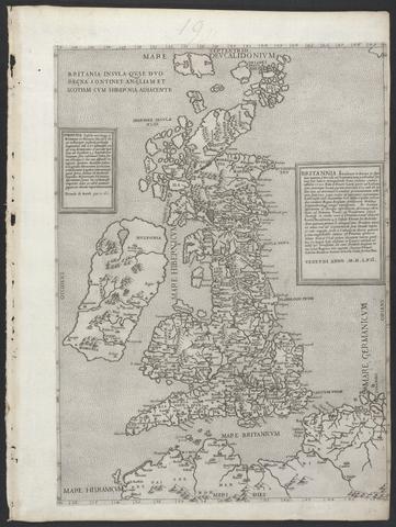
- Date:
- MDLVI [1556]
- Physical Description:
- 1 map ; 47.9 x 34.5 cm, on sheet 53.3 x 40.0 cm.
- Collection:
- Rare Books and Manuscripts

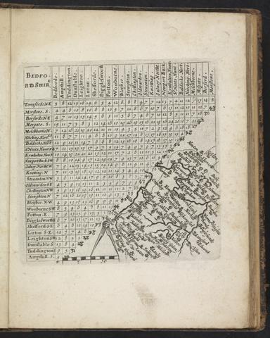
- Date:
- 1643
- Physical Description:
- [48] leaves (some folded) : maps ; 18 cm.
- Collection:
- Rare Books and Manuscripts

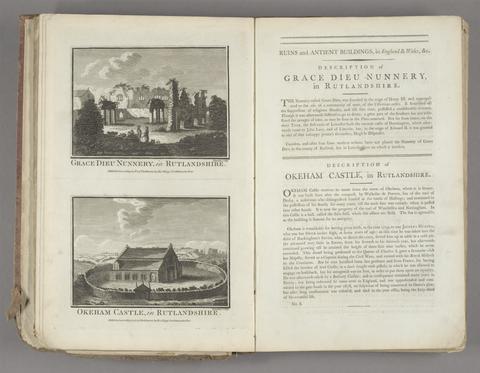
- Date:
- [1786]
- Physical Description:
- 1 v. (various pagings) : ill. ; 40 cm.
- Collection:
- Rare Books and Manuscripts
- Credit Line:
- Yale Center for British Art, Gift of Elizabeth Langhorne
![The theatre of the empire of Great Britaine : presenting an exact geography of the kingdomes of England, Scotland, Ireland, and the iles adioyning : with the shires, hundreds, cities and shire-townes, within [the] kingdome of England / divided and described by Iohn Speed.](https://media.collections.yale.edu/thumbnail/ycba/05faa311-179e-44bd-a185-63bd2c871197)
- Date:
- [1612]
- Physical Description:
- [14], 146 [that is 280], [10] pages : illustrations (woodcuts), 67 maps (metal cuts) ; 46 cm (folio)
- Collection:
- Rare Books and Manuscripts

- Date:
- [1678]
- Physical Description:
- 1 map : engraving ; 50 x 57 cm, on sheet 54 x 63 cm
- Collection:
- Rare Books and Manuscripts

- Date:
- [ca. 1700]
- Physical Description:
- [4] p., [44] leaves of plates, [1] folded : ill., maps ; 20 x 24 cm.
- Collection:
- Rare Books and Manuscripts

- Date:
- 1644
- Physical Description:
- 1 atlas ([1], [6] leaves) : 6 folded maps ; 23 cm.
- Collection:
- Rare Books and Manuscripts

- Date:
- MDLVIII [1558]
- Physical Description:
- 1 map ; 38.2 x 52.3 cm, on sheet 42.8 x 55.6 cm.
- Collection:
- Rare Books and Manuscripts

- Date:
- [1657]
- Physical Description:
- 1 atlas (234 pages in various pagings, [3] leaves of plates) : illustrations, maps, plans ; 52 cm (folio)
- Collection:
- Rare Books and Manuscripts

- Date:
- MDCLXXVI [1676]
- Physical Description:
- [16], 126, 5-6, 5-8, [22], 129-146, [14], 56, [12] pages, [2] leaves of plates : illustrations, coats of arms, tables ; 46 cm (folio)
- Collection:
- Rare Books and Manuscripts

- Date:
- anno cum privilegio 1616
- Physical Description:
- 1 atlas ([8], 94, [2], 99-126, [2], 131-132, [2], 137-146, [6] leaves) : maps ; 44 cm (folio)
- Collection:
- Rare Books and Manuscripts

- Date:
- [17--]
- Physical Description:
- 1 atlas (4 leaves) : hand col. maps ; 23 cm.
- Collection:
- Rare Books and Manuscripts

- Date:
- MDCLXXII [1673]
- Physical Description:
- [14], 464 pages, [63] leaves of plates (50 folded) : coats of arms, maps ; 36 cm (fol. in 4s)
- Collection:
- Rare Books and Manuscripts

- Date:
- anno MDLXII [1562]
- Physical Description:
- 1 map ; 47.0 x 34.2 cm, on sheet 53.2 x 40.0 cm.
- Collection:
- Rare Books and Manuscripts

- Date:
- MDCLXXII [1673]
- Physical Description:
- [14], 464 p., [113] leaves of plates (some folded) : ill., 50 maps plan ; 36 cm. (fol.)
- Collection:
- Rare Books and Manuscripts

- Date:
- [approximately 1695]
- Physical Description:
- 1 map : engraving, hand colored ; 46 x 56 cm, on sheet 51 x 61 cm
- Collection:
- Rare Books and Manuscripts

- Date:
- [approximately 1705]
- Physical Description:
- 1 map : engraving, hand-colored ; 46 x 58 cm, on sheet 54 x 65 cm
- Collection:
- Rare Books and Manuscripts

- Date:
- [1677?]
- Physical Description:
- 48 leaves (some folded) : maps ; 13 cm.
- Collection:
- Rare Books and Manuscripts

- Date:
- MDXLVI [1546]
- Physical Description:
- 1 map on 2 sheets ; 51.8 x 72.2 cm, on sheet 56.2 x 76.3 cm.
- Collection:
- Rare Books and Manuscripts

- Date:
- [1764]
- Physical Description:
- 1 atlas ([3], [22], [18] leaves) : 22 maps, 18 plans (some folded) ; 13 x 16 cm.
- Collection:
- Rare Books and Manuscripts

- Date:
- [circa 1610?]
- Physical Description:
- 1 atlas ([110 ] leaves) : 55 maps ; 43 cm
- Collection:
- Rare Books and Manuscripts

- Date:
- 1958
- Physical Description:
- 38 p. ; 32 cm.
- Collection:
- Reference Library
- Date:
- [1970]
- Physical Description:
- 16 p., 230 plates : 2 col. illus., coats of arms, maps. ; 54 cm
- Collection:
- Reference Library