Search Constraints
You searched for:
Credit Line Yale Center for British Art, Paul Mellon Collection
Remove constraint Credit Line: Yale Center for British Art, Paul Mellon CollectionImage Available Available
Remove constraint Image Available: AvailableSubject Terms map
Remove constraint Subject Terms: mapSearch Results

1
- Samuel Thomas Russell in Samuel Foote's "The Mayor of Garratt"
- between 1810 and 1811
- Not on view

2
- The Sense of Sight
- 1744 to 1747
- Not on view
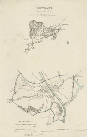
3
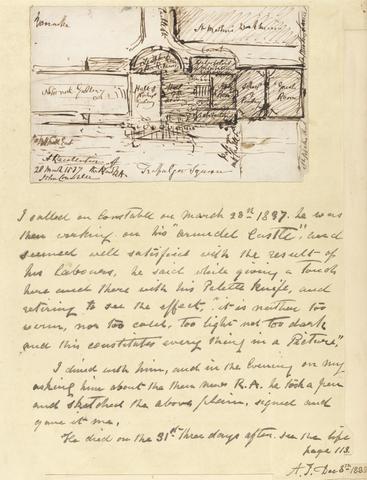
- A Recollection of the New R.A
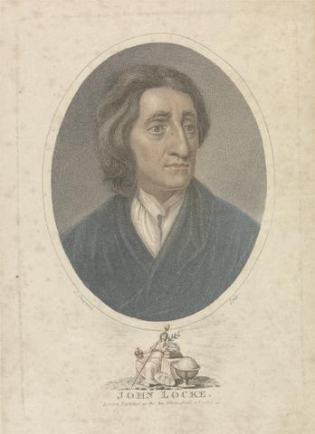
- 1837
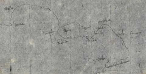
4
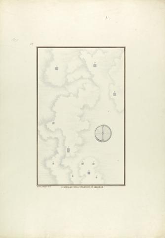
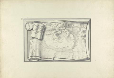
- Posizione delle Piramidi di Sachara
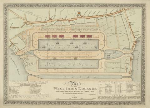
- ca. 1750

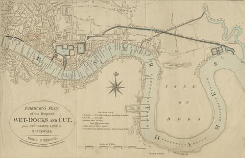
5
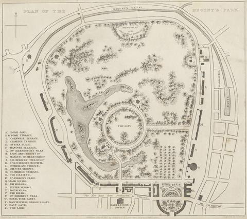
- The Damnation of Obadiah
- 1773
6
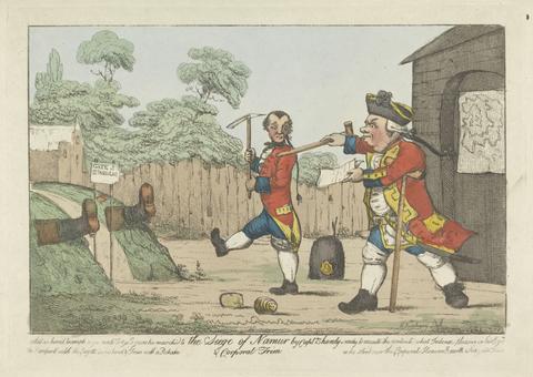
- The Siege of Namur
- between 1773 and 1817

7
- A Frank Encampment in the Desert of Mount Sinai. 1842 - The Convent of St. Catherine in the Distance
- 1856

8
- The Undergraduate's Room
- undated
9
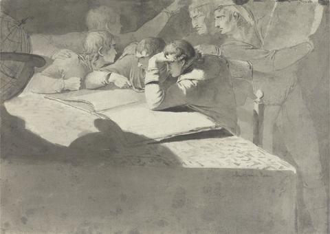
- The Geographers
- undated
![Mrs. P. D. H. Page Map of North America from Florida to Chesapeake Bay, after the original by John White in the British Museum [Sir Walter Raleigh's Virginia, No. 110]](https://media.collections.yale.edu/thumbnail/ycba/f14d2599-644f-40b2-8aee-01feeb08ac1a)
10
- Map of North America from Florida to Chesapeake Bay, after the original by John White in the British Museum [Sir Walter Raleigh's Virginia, No. 110]
- undated
![Mrs. P. D. H. Page Map of Raleigh's Virginia: The East Coast of North America from Cape Lookout to Chesapeake Bay, after original by John White in the British Museum [Sir Walter Raleigh's Virginia, No. 111 A]](https://media.collections.yale.edu/thumbnail/ycba/aa273bf1-4d54-4726-99f1-aa8836010023)
11
- Map of Raleigh's Virginia: The East Coast of North America from Cape Lookout to Chesapeake Bay, after original by John White in the British Museum [Sir Walter Raleigh's Virginia, No. 111 A]
- undated

12
- Sir Jeffery Amherst
- 1766

13
- The Damnation of Obadiah
- between 1773 and 1817
14
- Map of Bewdley from the Ordnance Survey
- undated

15
- Map of Worcestershire Showing Western and Eastern Divisions
- undated
16
- John Locke
- 1811
17
- Gulf of Naples Map
- undated
18
- Plan of the Ruins at Sardis with Vestiges of Ancient Buildings Still Existing in 1750
- ca. 1750
19
- Plan of the West India Docks
- 1802
20
- Fairburn's Plan of the Proposed Wet-Docks and Cut, from New Gravel Lane to Blackwall
- 1796
21
- Plan of the Regent's Park
- 1827